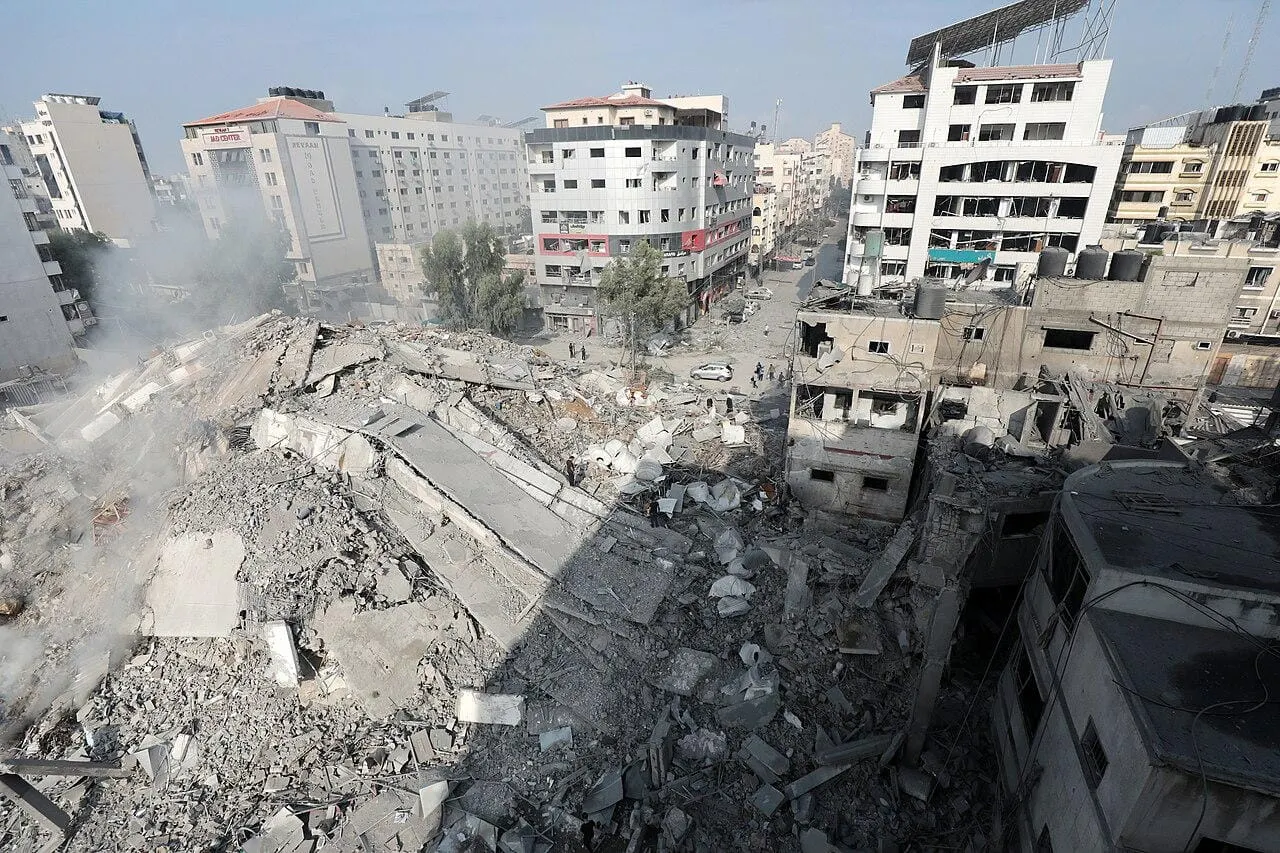
The Guardian has published a shocking, well-documented investigation into the destruction of buildings in Gaza, using satellite data to identify areas of destruction or damage to buildings.
The investigators documented damage to over 250 residential buildings, more than a dozen schools and universities, 16 mosques, 3 hospitals, 3 cemeteries, and over 100 agricultural greenhouses.
“Entire buildings have been leveled, fields flattened and places of worship wiped off the map in the course of Israel’s war against Hamas in Gaza,” explains the report. “The destruction has not only forced 1.9 million people to leave their homes but also made it impossible for many to return. This has led some experts to describe what is happening in Gaza as “domicide,” defined as the widespread, deliberate destruction of the home to make it uninhabitable, preventing the return of displaced people.” An earlier UN satellite study from December found that 39% of all agricultural land in Gaza had been affected.
The report, worth reviewing directly, puts particular focus on the agricultural town of Beit Hanoun, the al-Zahra and al-Mughraqa neighborhoods (where the Israa University was destroyed by placed charges), and the southern city of Khan Younis.
The report names Balakrishnan Rajagopal, the UN special rapporteur on the right to adequate housing, as citing UN data showing that 40% of the structures in Aleppo, Syria had been damaged during 2013-2016. In less than three months of conflict in Gaza, Rajagopal estimated that 60% of all structures have been damaged or destroyed. “The utter annihilation of Beit Hanoun and the destruction of al-Zahra and Khan Younis, are evidence that Israeli use of force has made life impossible by making them uninhabitable,” Rajagopal told The Guardian.
See the report, “How the War Destroyed Gaza’s Neighborhoods–Visual Investigation.”


