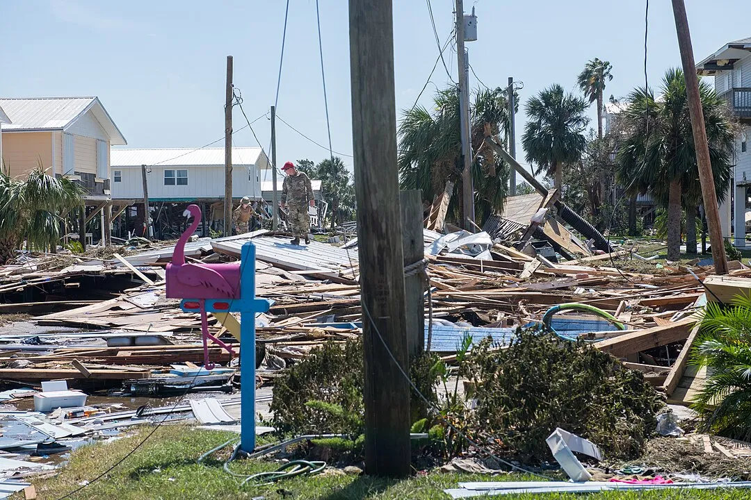
Approaching three weeks since Hurricane Helene swept up from the Gulf of Mexico through six Southeastern U.S. states, making landfall as a Category 4 storm on Sept. 26, the devastation is severe: 251 people are dead, half in North Carolina alone, and many communities remain without electricity. While much of the media coverage has claimed “global warming” is a cause, that explanation overlooks a crucial, actionable point: The inadequacy of the U.S. infrastructure and the nation’s physical economy overall. Research suggests that with proper flood control and water management systems, two-thirds to 90% of those who perished could still be alive today.
In Asheville, North Carolina, which experienced nearly 30% of the storm’s deaths, the need for comprehensive flood infrastructure is starkly visible. The city, located within a basin in the Blue Ridge Mountains, became a deadly flood zone during Hurricane Helene as torrents of water cascaded down mountain slopes, filling the “bowl” of Asheville with little means of escape. The French Broad and Swannanoa Rivers, which run through the city, further compounded the crisis, as the North Fork Dam—a reservoir meant only for water supply, not flood control—could not release water before the storm, which would have allowed it to capture some of the flood waters.
And there was desperately little or none at all of categories of flood control infrastructure—including insufficient flood control dams, a scarcity of levees and flood restraining walls, inadequate inter-basin water management, etc., and grossly inadequate pre-positioning of helicopters, and medical and emergency supplies. This is what is estimated to have caused 66-90% of the deaths in Buncombe County (Asheville) and western North Carolina, and infrastructure shortages and inadequacy caused a similar death rates in the other five states of Florida, Georgia, South Carolina, Virginia, and Tennessee.
This situation highlights a recurring issue in Asheville and similar regions, where inadequate infrastructure consistently fails to prevent tragedy during extreme weather. Major floods in Asheville during storms in 1916, 2011, 2021, and again in 2024 underline this history of vulnerability, largely due to underinvestment in flood control. Basic yet essential structures like flood-control dams, levees, and water-management systems are underdeveloped. Effective flood prevention would have allowed water to be safely redirected or contained, sparing homes and lives. The cycle of vulnerability must end, and focusing on “global warming” while not building the necessary infrastructure to deal with the vagaries of nature, is not the way to do it.
South Carolina, which suffered at least 33 deaths, presents a similar example of the need for infrastructure. The American Society of Civil Engineers has given the state’s dams a grade of “D−".
It should be noted that the National Guard and other forces play a crucial role in responding to and helping recovery from disaster. But the aim is, first, through infrastructure, to prevent the disaster from occurring or to mitigate it; then one won’t need, or will need on a significantly reduced scale, the National Guard to save someone from a flooding home, if the home did not flood in the first place.
The Army Corps of Engineers, and other appropriate agencies, in addition to the basic infrastructure, may have to do some further extension of their work in figuring out how to build flood-control systems on mountainsides, or in mountain valleys. But they have worked on difficult questions before, and solved them. While the National Guard plays a critical role in rescuing and aiding disaster survivors, such emergency responses would be far less necessary if infrastructure were designed to mitigate flooding. If homes and communities could avoid flooding altogether, rescue resources could be reserved for the most urgent cases.
(Note: Western North Carolina is part of the Ridge and Valley physiographic area, part of the Appalachian Highlands in the eastern United States. It is bordered on the east by the Blue Ridge and Piedmont zones and on the west by the Appalachian Plateau. As its name implies, the area is a series of alternating ridges and valleys. This extends for nearly 1,200 miles (1,930 km) from the St. Lawrence Valley in upstate New York to the Coastal Plain of central Alabama. When storm rain-soaked clouds run up the eastern side of the Appalachian mountains, the water is discharged into the valleys. This process has occurred for a good part of about 230 million years, the age of the Appalachian Mountains.)


